
Our Equipment
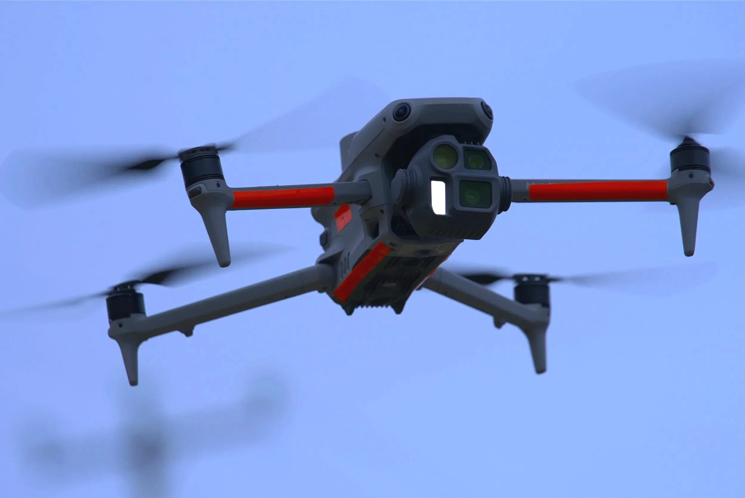
DJI Matrice 4E - Enterprise Drone Platform
The DJI Matrice 4E is a professional enterprise drone platform built for demanding real-world operations. It is the tool of choice for operators who need accuracy, reliability and versatility across a wide range of applications.
What it can do:
Aerial Mapping & Survey Pre-programmed automated flight missions capture high-resolution geotagged imagery across large areas with centimetre-level precision when connected to RTK. Ideal for land surveys, construction site mapping and topographical data capture.
Infrastructure Inspection Three calibrated cameras - wide, telephoto and ultra-wide - allow detailed close-range inspection of roofs, bridges, masts, wind turbines and facades. Mechanical shutter eliminates motion blur for sharp, usable imagery at every angle.
Automated Patrols & Monitoring Repeatable pre-programmed flight routes allow consistent monitoring of sites, boundaries and assets over time - delivering comparable data across visits for progress tracking and change detection.
Search & Rescue Support Extended 43 minute flight time, 20km transmission range and omnidirectional obstacle sensing make the Matrice 4E a capable platform for supporting search and rescue operations across remote and challenging terrain.*
Real Estate & Visual Content 4K video and 50MP stills across three lenses deliver broadcast quality imagery for property marketing, planning applications and development documentation.
Purpose built for professionals. Not a consumer drone with a camera attached.
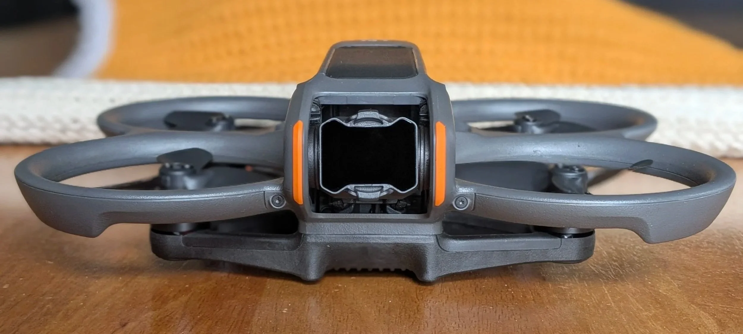
DJI Avata 2 - FPV Speciality Applications
The Avata 2 is a compact FPV drone weighing just 377g, capturing 4K/60fps HDR video at a dramatic 155° ultra-wide field of view. Where the Matrice 4E is built for precision data capture, the Avata 2 is built for immersive, dynamic visual storytelling.
What it can do:
Cinematic Real Estate & Property Content The ultra-wide 155° field of view and low altitude agility allow dramatic flythrough shots of properties, interiors and landscapes that standard drones simply cannot achieve. Ideal for estate agents and property developers who want content that genuinely stands out.
Confined Space & Close Range Inspection Integrated propeller guards and a binocular fisheye visual positioning system allow the Avata 2 to fly safely through tight spaces and at low altitudes — getting close to structures, under bridges, inside buildings and around complex infrastructure where larger drones cannot safely operate.
Immersive Site Documentation First person view footage gives clients, architects and project managers a genuine sense of scale and environment — particularly powerful for construction progress, site surveys and planning applications.
Tourism & Promotional Content Dynamic low altitude coastal and landscape footage for tourism operators, accommodation providers and Wild Atlantic Way businesses — the kind of content that stops the scroll on social media.
Where precision data needs a specialist platform, compelling visuals need the Avata 2.
DJI Mini 5 Pro - Lightweight Precision Camera Drone
The DJI Mini 5 Pro is the first sub-250 gram drone with a 1-inch sensor — meaning professional image quality in a platform compact and agile enough to go anywhere. It combines the benefits of being lightweight while delivering image quality previously only achievable with larger, heavier platforms.
What it can do:
Property & Real Estate Photography The 4k 50MP 1-inch CMOS sensor with f/1.8 lens captures sharp, detailed imagery ideal for property listings, planning applications and development documentation. Compact size means it can operate in tighter locations where larger drones cannot.
Rural & Remote Area Coverage Up to 50 minutes flight time and 25km O4+ transmission range makes it ideal for covering large rural landholdings, coastal areas and remote sites where extended coverage is needed.*
Social & Marketing Content True vertical shooting with 225° gimbal rotation delivers network-ready content optimised for social media — perfect for tourism operators, accommodation providers and businesses wanting strong online presence.
Rapid Deployment At under 250 grams it packs into any bag and deploys in minutes — ideal for quick site visits, preliminary surveys and locations where setup time and access are limited.
Low Light & All Conditions Forward LiDAR and omnidirectional vision sensors provide obstacle detection even in low light — extending operational capability into early morning and evening conditions where the best light for photography occurs.
Operational Flexibility — C0 Classification
Weighing under 250 grams the DJI Mini 5 Pro falls within the C0 weight classification under EASA and IAA drone regulations. This is a significant operational advantage — C0 aircraft can be flown closer to people and buildings than heavier platforms, with reduced regulatory restrictions in many scenarios. For urban surveys, property photography in built up areas, and inspections near occupied structures, the Mini 5 Pro can operate where larger drones legally cannot — without compromising on image quality.
Big capability. Minimal footprint. Deployable anywhere.
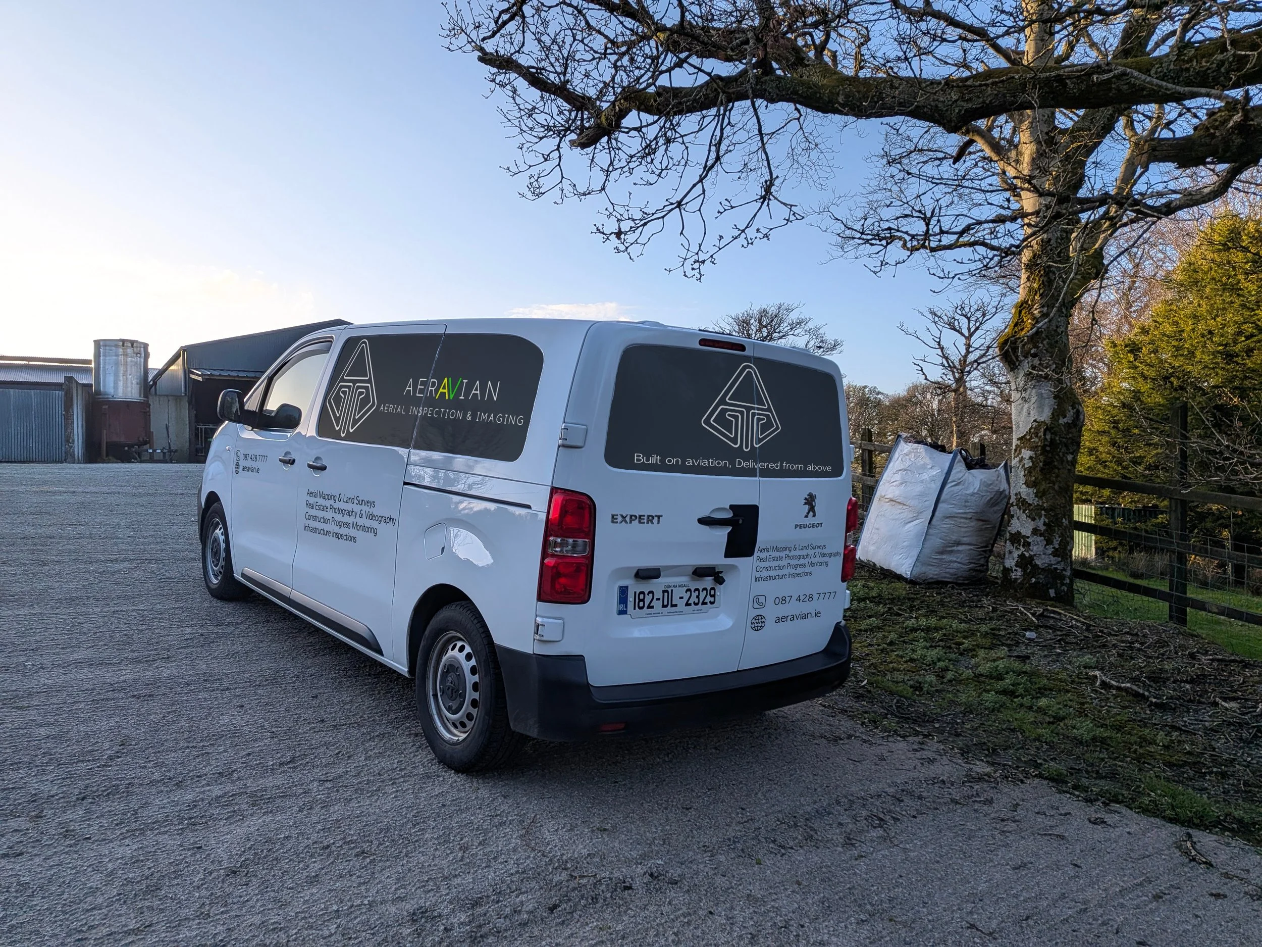
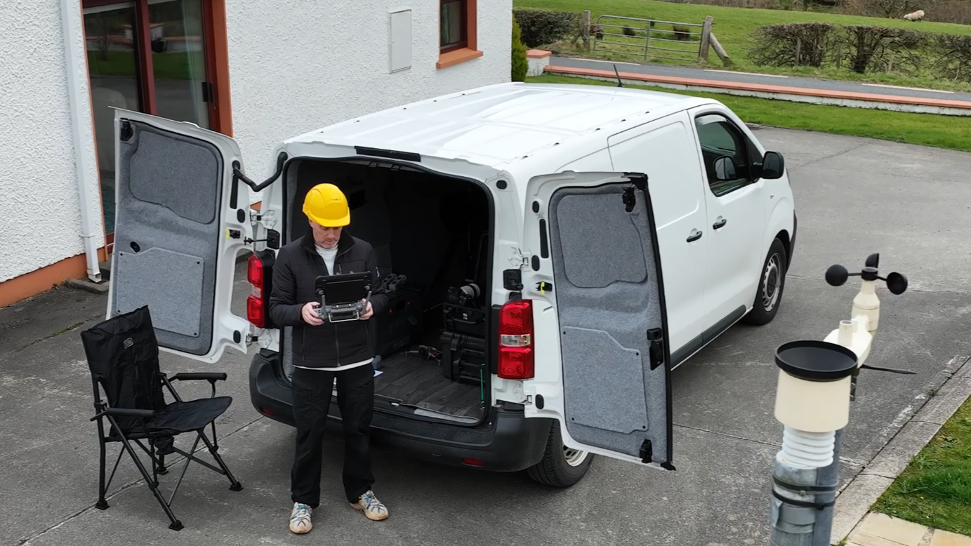
Aeravian Mobile Operations Unit
Professional drone operations don't end when the aircraft lands. Aeravian operates from a fully equipped mobile operations unit — a dedicated vehicle configured to support every aspect of a professional drone deployment, on location and on demand.
What it carries:
240V Power Supply Onboard 240V power supports equipment charging, laptop operation and peripheral devices in the field — eliminating dependence on site power and allowing Aeravian to operate as a fully self-sufficient unit in remote locations, rural sites and areas without infrastructure.
Client Viewing Screen A dedicated monitor allows clients, site managers and stakeholders to view live camera feeds directly from the drone during operations. No need to crowd around a controller screen — clients see exactly what the drone sees, in real time, from a comfortable vantage point. Ideal for inspection walkthroughs, site monitoring and real estate shoots where immediate client sign-off on coverage is required.
Onboard Computing & Data Processing
The mobile unit carries a dedicated laptop setup capable of preliminary data review, footage inspection and basic editing directly in the field. While full processing of mapping and survey data requires high speed internet and dedicated software back at base, clients benefit from immediate on-site review of captured imagery — flagging any areas requiring a second pass before the aircraft is packed away, and confirming coverage and quality before leaving the location.
Equipment & Payload Management The vehicle is configured to transport protect and deploy the full Aeravian fleet — Matrice 4E, Avata 2 and Mini 5 Pro — along with batteries, controllers, accessories and operational documentation, organised and ready to deploy at a moment's notice.
Aeravian arrives prepared. Every time.
* All Aeravian flight operations are conducted within Visual Line of Sight (VLOS) in full compliance with Irish Aviation Authority regulations. Transmission range and flight time specifications reflect manufacturer capabilities under optimal conditions. Operational range on all flights is determined by VLOS requirements and applicable regulatory frameworks.